Interactive map

Historical objects in the “Interactive Map”

Traces of cultural and historical evidence in the municipality of Kürten digital explore…

We would like to introduce you to the historical objects in the municipality of Kürten and the surrounding area using an interactive map.


Of course, it is much more fun to explore the historical objects "REAL and on site", which we would like to encourage you to do. With this map you have the opportunity to more easily assign all historical objects locally and then set off for a visit. The original author of the overview map is Stefanie Kurth.


This page is still under construction and we look forward to receiving further ideas and suggestions from you.

Have fun discovering and exploring...


In a small "Presentation Video" we will show you how you can use the interactive map.


How to use the "intercative map"

- all CONTROL FUNCTIONS:

  • Presentation video

    You can watch some basic functions described in the presentation video.

  • MOVING the map

    Move the mouse to the area of the map you want to move, then hold down the left mouse button and move the area with the mouse.

  • ENLARGE/REDUCE the map

    Move the mouse to the area of the map you want to move, then turn the mouse wheel in the middle to zoom in on the map.

  • Open OBJECT SELECTION MENU

    To display all historical objects, click on the "OPEN SYMBOL" in the map display with the mouse at the top left.

  • SELECT a historical object

    Hover your mouse over the historical object. When the mouse pointer becomes a hand symbol with an extended index finger, left-click the mouse to display the object

  • Back to overview

    To return to the complete overview, press the BACK ICON in the OBJECT DESCRIPTION area at the top left.

  • ROUTE to the historical object

    When you are in the property description, a ROUTE ICON will appear at the top right of the description. Click on the route ICON to create a driving route from the starting point of your choice to the historical object.

  • Change MAP DISPLAY

    If you have opened the OBJECT SELECTION MENU, you will find a MAP ICON at the bottom of the list. Click the MAP ICON to customize the map display (either simplified display or satellite map).

Presentation video


Background:


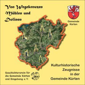
In 2009, the History Association for the Municipality of Kürten and Surroundings recorded cultural-historical objects such as churches and chapels, houses and mills, tombstones and devotional crosses on behalf of the municipality of Kürten and with the help of the working group >History / Cultural History Mission Statement Kürten 2020 < in the brochure Of crossroads, mills and sinkholes compiled.


You can do the book

HERE

order ...


Share by: